Research: Build a Destination Brief
A postcard shows you a sunny cathedral facade; it never discloses that the nearest reliable pharmacy is 4 kilometers up a cobblestone incline, or that Sunday municipal transport terminates at mid-day. Here is how to construct a rigorous destination dossier.
Why Most Destination Research Misleads Travelers
The modern web prioritizes visual inspiration over logistical feasibility. When an algorithm serves a dramatic reel of a seaside village in the Cinque Terre or a remote village in the Scottish Highlands, it abstracts away three critical operational facts: how you enter, how you move inside the terrain with luggage, and what everyday baseline services cost.
At TallyTroveRadarPi, we instruct travelers to write a one-page "Destination Brief" before bookmarking a single rental property. This brief answers four pragmatic pillars:
- Transit Geometry: What is the frequency and operating window of the primary commuter artery?
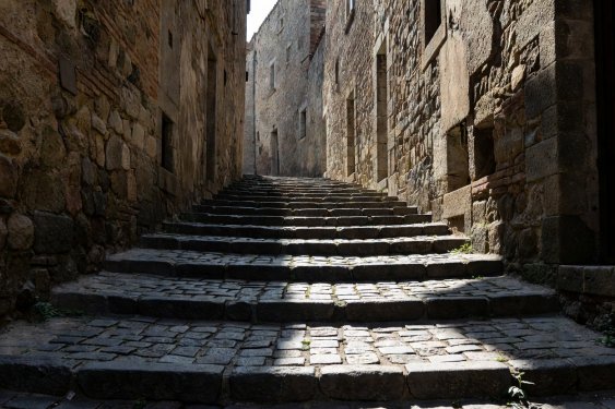
- Topography & Mobility: Are streets graded, stepped, or restricted to authorized delivery vehicles?
- Microclimate & Daylight Hours: What is the realistic usable daylight span and precipitation profile?
- Regulatory & Commercial Cadence: When do bakeries, groceries, and clinics close weekly?
Step 1: Auditing Topography and Neighborhood Friction
A distance of 600 meters on a flat map looks negligible. In destinations like Lisbon, Edinburgh, Toledo, or Valparaíso, that 600 meters might represent a 90-meter vertical ascent over uneven stone steps.
If you are traveling with medium wheeled luggage or have knee constraints, selecting an apartment at the crest of an inaccessible lane transforms every departure into an exhausting ordeal. Use satellite terrain profiles and street-level imagery to assess road surfacing, step frequencies, and vehicular drop-off zones before booking.
 Topography Audit
Vertical Elevation Checks
Learn how to calculate grade slope and step incidence between transit stops and prospective accommodation.
 Neighborhood Buffer
Noise and Commercial Buffers
Identifying late-night nightlife thoroughfares versus quiet residential lanes using municipal delivery zoning maps.
Step 2: Rail and Regional Timetable Verification
Never trust generalized transit advice written three years ago. Regional lines throughout France (TER), Germany (Regionalbahn), and Italy (Regionale) run seasonal timetables that alter drastically on Sundays, during university holidays, and during autumn track renewal campaigns.
Always locate the direct operator portal:
- For France: SNCF Connect (look for “Fiches horaires” downloadable PDFs rather than relying solely on automated search algorithms).
- For Italy: Trenitalia and regional consortiums like Trenord in Lombardy or Ente Autonomo Volturno in Campania.
- For Germany: Deutsche Bahn (DB Navigator) with the “Local transport only” filter activated.
- For Spain: Renfe Cercanías and regional operators like FGC or Euskotren.
Case Study: The South Moravian Corridor
Consider an independent traveler seeking architectural heritage and calm wine hills without the crowds of Prague. Rather than booking an isolated rural farmhouse that mandates high-cost car rental, a rigorous destination brief reveals the rail corridor running south from Brno toward Břeclav.
Modern, frequent regional trains depart every 30 to 60 minutes. Base accommodation in Mikulov or Znojmo costs a fraction of metropolitan rates, while direct trains deliver you into the cultural heart of Vienna in under 80 minutes. The destination brief turns what seemed like a complicated multi-country trip into a frictionless, low-cost commuter sequence.